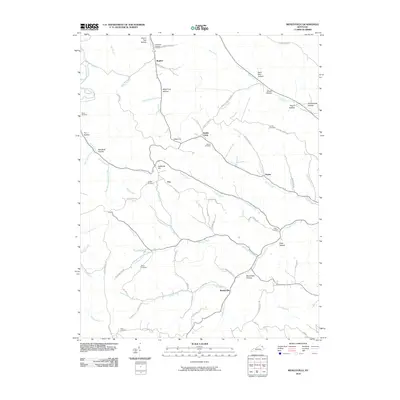
2010 Map of Wesleyville
USGS Topo · Published 2010About this map
Wesleyville and the winding waters of Buffalo Creek anchor this documentation of Carter County's rural landscape. The settlement patterns follow the intricate stream network, with homes and small communities like Poplar, Eby, and Smiths Creek situated along the narrow valley floors. The naming of the landscape reveals a deep local history, with numerous family-named hollows and branches such as Bruce Hollow, Lambert Hollow, and Polly Moore Branch providing clues for genealogists and local historians.
Find a feature on this map
77 named features on this map. Tap any name to fly to it.
Don’t see what you’re looking for? This feature index may not catch every label — zoom into the map to look around manually.
Map Details
Editions of this 2010 Wesleyville Map
This is the sole edition of this map. No revisions or reprints were ever made.
Other maps of this area

1915 · Garrison
USGS Topo · 1:62,500

1918 · Garrison
USGS Topo · 1:62,500

1919 · Vanceburg
USGS Topo · 1:62,500

1949 · Vanceburg
USGS Topo · 1:62,500

1949 · Garrison
USGS Topo · 1:24,000

1949 · Vanceburg
USGS Topo · 1:24,000

1949 · Brushart
USGS Topo · 1:24,000

1950 · Brushart
USGS Topo · 1:24,000

1950 · Head Of Grassy
USGS Topo · 1:24,000

1950 · Grahn
USGS Topo · 1:24,000