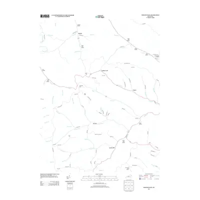
2013 Map of Wesleyville
USGS Topo · Published 2013About this map
Wesleyville and Smiths Creek anchor a landscape defined by deep-set hollows and winding ridgeline roads in this early twenty-first-century survey of northeastern Kentucky. The topography is intricately detailed, showing the convergence of Brushy Cr and Smith Cr near Poplar, while numerous family-named landmarks like Jordan Cem and Sexton Cem provide valuable touchpoints for genealogical research. The map captures a transition in the rural environment, where traditional settlements such as Rugless and Eby are connected by a network of named routes including Stafford Hill Rd and Bethel Rdg. Notable terrain features such as Deep Cut and the prominent Staffords Hill overlook the many forks and branches of the Kinniconick and Tygarts watersheds, including McGlone Fork and Jordan Fork. The presence of the Womstead Field Airport near the southern boundary reflects modern infrastructure amidst the longstanding names of the Kentucky hills.
Find a feature on this map
93 named features on this map. Tap any name to fly to it.
Don’t see what you’re looking for? This feature index may not catch every label — zoom into the map to look around manually.
Map Details
Editions of this 2013 Wesleyville Map
This is the sole edition of this map. No revisions or reprints were ever made.
Other maps of this area

1915 · Garrison
USGS Topo · 1:62,500

1918 · Garrison
USGS Topo · 1:62,500

1919 · Vanceburg
USGS Topo · 1:62,500

1949 · Vanceburg
USGS Topo · 1:62,500

1949 · Garrison
USGS Topo · 1:24,000

1949 · Vanceburg
USGS Topo · 1:24,000

1949 · Brushart
USGS Topo · 1:24,000

1950 · Brushart
USGS Topo · 1:24,000

1950 · Head Of Grassy
USGS Topo · 1:24,000

1950 · Grahn
USGS Topo · 1:24,000