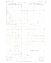
1951 Map of Wessington SW
USGS Topo · Published 1951About this map
Hulbert and Wessington townships anchor this 1951 prairie landscape, mapped during a period of coordinated regional planning for the Missouri River Basin. The area is defined by a sparse but organized network of rural education centers, including McNeil Sch, Sand Creek Sch, and McGillvery Sch. These local institutions, alongside Domseh Sch and Watson Sch, reflect the distributed settlement pattern typical of the South Dakota plains before the consolidation of rural school districts.
Find a feature on this map
15 named features on this map. Tap any name to fly to it.
Don’t see what you’re looking for? This feature index may not catch every label — zoom into the map to look around manually.
Map Details
Editions of this 1951 Wessington SW Map
3 editions found
Other maps of this area

1949 · Vayland SE
USGS Topo · 1:24,000

1950 · Vayland
USGS Topo · 1:24,000

1950 · Wessington
USGS Topo · 1:24,000

1950 · Wessington NE
USGS Topo · 1:24,000

1951 · Wessington SE
USGS Topo · 1:24,000

1951 · Wessington SW
USGS Topo · 1:24,000

1951 · Vayland SE
USGS Topo · 1:24,000

1953 · Huron
USGS Topo · 1:250,000

1954 · Huron
USGS Topo · 1:250,000

1973 · Wessington Springs NE
USGS Topo · 1:24,000