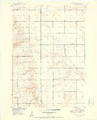
1951 Map of Wessington SW
USGS Topo · Published 1951About this map
The Hand Co and Beadle Co line runs vertically through this 1951 agricultural landscape, marking a rural district defined by small township schools and drainages. The area is characterized by a high density of local educational hubs, including McNeil Sch in the north and Domach Sch and Watson Sch in the south, reflecting a period when small-scale rural schooling was still the center of community life before widespread consolidation.
Find a feature on this map
14 named features on this map. Tap any name to fly to it.
Don’t see what you’re looking for? This feature index may not catch every label — zoom into the map to look around manually.
Map Details
Editions of this 1951 Wessington SW Map
3 editions found
Other maps of this area

1949 · Vayland SE
USGS Topo · 1:24,000

1950 · Vayland
USGS Topo · 1:24,000

1950 · Wessington
USGS Topo · 1:24,000

1950 · Wessington NE
USGS Topo · 1:24,000

1951 · Wessington SE
USGS Topo · 1:24,000

1951 · Wessington SW
USGS Topo · 1:24,000

1951 · Vayland SE
USGS Topo · 1:24,000

1953 · Huron
USGS Topo · 1:250,000

1954 · Huron
USGS Topo · 1:250,000

1973 · Wessington Springs NE
USGS Topo · 1:24,000