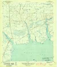
1944 Map of West Bay
USGS Topo · Published 1944About this map
West Bay stands at the heart of this wartime survey, showing the coastal landscape of Bay County during a period of significant military and infrastructure development. The Intracoastal Waterway cuts through the marshy terrain, providing a critical transportation corridor south of the settlement at West Bay. The area is defined by a complex network of freshwater drainages, including Burnt Mill Creek and Crooked Creek, which flow through low-lying wetlands before reaching the open water of the bay.
Find a feature on this map
18 named features on this map. Tap any name to fly to it.
Don’t see what you’re looking for? This feature index may not catch every label — zoom into the map to look around manually.
Map Details
Editions of this 1944 West Bay Map
4 editions found
Other maps of this area

1943 · Laguna Beach
USGS Topo · 1:31,680

1943 · Panama City
USGS Topo · 1:31,680

1943 · Panama City Beach
USGS Topo · 1:31,680

1943 · Seminole Hills
USGS Topo · 1:24,000

1943 · West Bay
USGS Topo · 1:24,000

1943 · Southport
USGS Topo · 1:24,000

1944 · Southport
USGS Topo · 1:24,000

1944 · Seminole Hills
USGS Topo · 1:31,680

1944 · West Bay
USGS Topo · 1:31,680

1944 · Crystal Lake
USGS Topo · 1:24,000