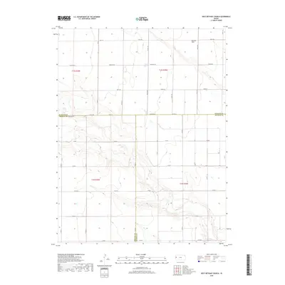
2018 Map of West Bethany Church
USGS Topo · Published 2018About this map
Harrison Flats dominates the high ground in this section of the High Plains, where the borders of Greeley, Wallace, and Wichita counties converge. The landscape is defined by a rigorous grid of section lines and rural thoroughfares that reflect the enduring patterns of the Public Land Survey System in western Kansas. Navigating this open terrain relies on descriptively named routes such as Dusty Rd, Bumpy Rd, and Crosswind Rd, which follow the township lines of t15s r38w and surrounding ranges. The area is characterized by sparse development, with long-established county roads like Co Rd 1951 and Arrowhead Rd providing the primary connectivity between scattered agricultural holdings and the expansive flats. This map offers a clear view of the territorial divisions and the network of unpaved roads essential to the region's ranching and farming operations.
Find a feature on this map
68 named features on this map. Tap any name to fly to it.
Don’t see what you’re looking for? This feature index may not catch every label — zoom into the map to look around manually.
Map Details
Editions of this 2018 West Bethany Church Map
This is the sole edition of this map. No revisions or reprints were ever made.
Other maps of this area

1955 · Scott City
USGS Topo · 1:250,000

1958 · Scott City
USGS Topo · 1:250,000

1959 · Wallace
USGS Topo · 1:62,500

1968 · Russell Springs 3 SW
USGS Topo · 1:24,000

1968 · Russell Springs 3 NW
USGS Topo · 1:24,000

1968 · Sharon Springs 4 NW
USGS Topo · 1:24,000

1968 · Sharon Springs 4 NE
USGS Topo · 1:24,000

1969 · Russell Springs 2 SW
USGS Topo · 1:24,000

1970 · Sharon Springs 4 SE
USGS Topo · 1:24,000

1970 · Sharon Springs 4 SW
USGS Topo · 1:24,000