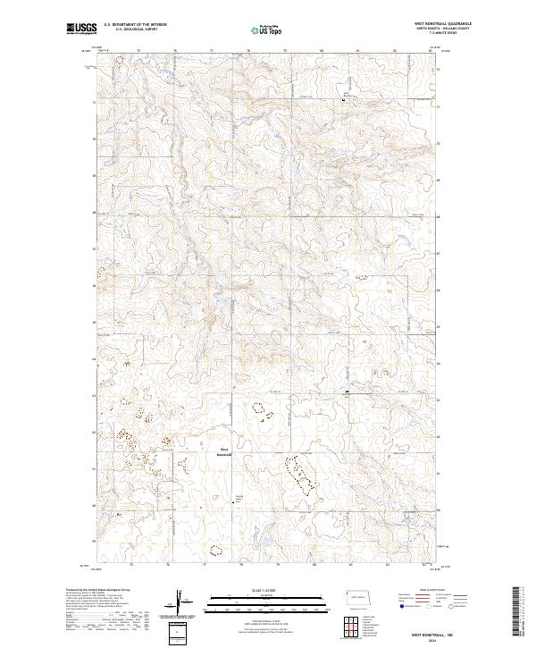
2024 Map of West Bonetraill
USGS Topo · Published 2024About this map
West Bonetraill sits at the center of this high-plains landscape in Williams County, where the topography is defined by the drainage of Willow Creek. The map reflects a quiet rural character, where the grid of sections is primarily traced by gravel roads such as 150th Ave NW and 70th St NW. The presence of several distinct burial grounds, including Saint Boniface Cem in the northeast and Saint Petri Cem further south, suggests the long-standing communities that settled this portion of North Dakota. Between these landmarks, Scandia Valley Cem provides another point of interest for genealogists tracing local families. The landscape remains largely open, partitioned by Co Hwy 10 as it crosses the township lines of t158n r103w and t157n r102w.
Find a feature on this map
24 named features on this map. Tap any name to fly to it.
Don’t see what you’re looking for? This feature index may not catch every label — zoom into the map to look around manually.
Map Details
Editions of this 2024 West Bonetraill Map
This is the sole edition of this map. No revisions or reprints were ever made.
Other maps of this area

1946 · Brush Lake
USGS Topo · 1:24,000

1948 · Grenora
USGS Topo · 1:24,000

1948 · Hanks
USGS Topo · 1:24,000

1948 · Brush Lake
USGS Topo · 1:24,000

1953 · Williston
USGS Topo · 1:250,000

1954 · Wolf Point
USGS Topo · 1:250,000

1957 · Williston
USGS Topo · 1:250,000

1958 · Wolf Point
USGS Topo · 1:250,000

1974 · Bonetraill
USGS Topo · 1:24,000

1974 · Brush Mountain
USGS Topo · 1:24,000