
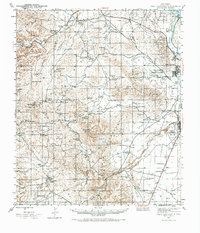
1943 Map of West Carlsbad
USGS Topo · Published 1964About this map
The Pecos River corridor and its surrounding Chihuahuan Desert uplands define this 1943 survey, a landscape transitioning from an agricultural and ranching frontier to a strategic military hub during World War II. The map highlights the intensive water management systems vital to the region, including the Southern Canal, Lake Avalon, and Spencer Dam. The presence of the Carlsbad Army Air Field near Dark Canyon underscores the area's wartime importance, while the scattered ranching infrastructure — from the Denny Ranch to the Gerry Smith Ranch — speaks to a generations-old livestock economy.
Find a feature on this map
63 named features on this map. Tap any name to fly to it.
Don’t see what you’re looking for? This feature index may not catch every label — zoom into the map to look around manually.
Map Details
Editions of this 1943 West Carlsbad Map
2 editions found
Other maps of this area

1939 · Carlsbad
USGS Topo · 1:62,500

1940 · Bandanna Point
USGS Topo · 1:62,500

1940 · Carlsbad Caverns West
USGS Topo · 1:62,500

1943 · Carlsbad
USGS Topo · 1:62,500

1943 · Carlsbad Caverns West
USGS Topo · 1:62,500

1943 · Oil City
USGS Topo · 1:62,500

1943 · Bandanna Point
USGS Topo · 1:62,500

1945 · West Carlsbad
USGS Topo · 1:62,500

1945 · Carlsbad Caverns East
USGS Topo · 1:62,500

1945 · Malaga
USGS Topo · 1:62,500