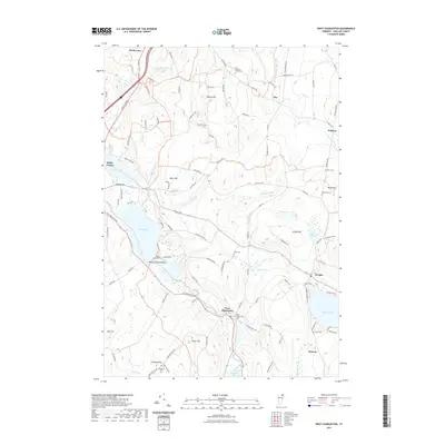
2021 Map of West Charleston
USGS Topo · Published 2021About this map
Derby Line stands at the international boundary in this 2021 topographic record of Orleans County, Vermont. The landscape is defined by the winding course of the Clyde River, which connects several significant water bodies including Lake Salem and Seymour Lake. Small settlements like West Charleston and Morgan serve as local hubs for the surrounding upland terrain. The map is a valuable resource for genealogists, as it meticulously identifies numerous family-named burial sites such as the Tice - Marston - Moon Cem, Mead Hill Cem, and the Wilcox Cem. Upland features like Nelson Hill and Cargill Hill overlook a network of rural roads, including the Morgan-Charleston Rd and Holland Rd. The inclusion of Balm of Gilead Beach and Pensioner Pond highlights the area's long-standing connection to its lakes and waterways.
Find a feature on this map
101 named features on this map. Tap any name to fly to it.
Don’t see what you’re looking for? This feature index may not catch every label — zoom into the map to look around manually.
Map Details
Editions of this 2021 West Charleston Map
This is the sole edition of this map. No revisions or reprints were ever made.
Other maps of this area

1919 · Lake Memphremagog
USGS Topo · 1:62,500

1920 · Derby
USGS Topo · 1:62,500

1923 · Lake Memphremagog
USGS Topo · 1:48,000

1924 · Island Pond
USGS Topo · 1:48,000

1925 · Memphremagog
USGS Topo · 1:62,500

1926 · Island Pond
USGS Topo · 1:62,500

1949 · Jackman
USGS Topo · 1:250,000

1950 · Lake Champlain
USGS Topo · 1:250,000

1950 · Lewiston
USGS Topo · 1:250,000

1953 · Island Pond
USGS Topo · 1:62,500