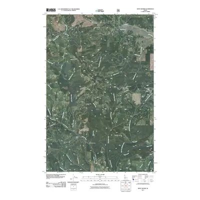
2011 Map of West Dennis
USGS Topo · Published 2011About this map
North South Ski Bowl and the small settlements of West Dennis and East Dennis anchor this 2011 survey of the Idaho timber and recreation lands. The terrain is defined by a dense network of mountain drainages, including the headwaters of Santa Creek, Hangman Creek, and Willow Creek, which flow through deep gulches like Bedrock Gulch and Stria Gulch. High points such as Charles Butte and Fairview Knob offer vantage points over the St. Joe National Forest area, where legacy forest service roads like Dennis Mountain Rd and Tetaw Ridge Rd provide access to remote sites like Cedar Grove Camp and the uniquely named Chetche'mch'm Meadow. The map's detail reflects the region's character as a site for both seasonal winter sports and year-round forestry management, preserving the nomenclature of 20th-century mountain development.
Find a feature on this map
80 named features on this map. Tap any name to fly to it.
Don’t see what you’re looking for? This feature index may not catch every label — zoom into the map to look around manually.
Map Details
Editions of this 2011 West Dennis Map
This is the sole edition of this map. No revisions or reprints were ever made.
Other maps of this area

1955 · Pullman
USGS Topo · 1:250,000

1955 · Spokane
USGS Topo · 1:250,000

1957 · Emida
USGS Topo · 1:62,500

1957 · Tensed
USGS Topo · 1:62,500

1958 · Spokane
USGS Topo · 1:250,000

1958 · Pullman
USGS Topo · 1:250,000

1960 · Potlatch
USGS Topo · 1:62,500

1961 · Deary
USGS Topo · 1:62,500

1981 · St Maries
USGS Topo · 1:100,000

1981 · Potlatch
USGS Topo · 1:100,000