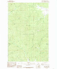
1985 Map of West Dennis
USGS Topo · Published 1985About this map
St Joe National Forest dominates this mid-1980s landscape, where the mountainous terrain of northern Idaho reaches heights at West Dennis and East Dennis. The map documents a complex drainage system defining the Idaho panhandle, with numerous gulches and creeks feeding into larger arteries like Santa Creek and the South Fork. The boundary between Benewah Co and Latah Co cuts through the southern half of the quadrangle, marking a transition between high-elevation landmarks such as Charles Butte and the remote drainage of Big Creek. This provisional survey provides a specific look at the forest's topographic character before late-twentieth-century changes, noting landforms like Fairview Knob and Three Tree Butte that served as primary reference points for local navigation and forestry management.
Find a feature on this map
34 named features on this map. Tap any name to fly to it.
Don’t see what you’re looking for? This feature index may not catch every label — zoom into the map to look around manually.
Map Details
Editions of this 1985 West Dennis Map
This is the sole edition of this map. No revisions or reprints were ever made.
Other maps of this area

1955 · Pullman
USGS Topo · 1:250,000

1955 · Spokane
USGS Topo · 1:250,000

1957 · Emida
USGS Topo · 1:62,500

1957 · Tensed
USGS Topo · 1:62,500

1958 · Spokane
USGS Topo · 1:250,000

1958 · Pullman
USGS Topo · 1:250,000

1960 · Potlatch
USGS Topo · 1:62,500

1961 · Deary
USGS Topo · 1:62,500

1981 · St Maries
USGS Topo · 1:100,000

1981 · Potlatch
USGS Topo · 1:100,000