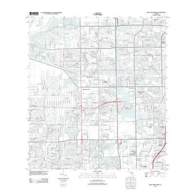
2012 Map of West Dixie Bend
USGS Topo · Published 2012About this map
Hillsboro Canal cuts a straight path through this densely developed corridor of Broward County, illustrating the modern water management and urban planning of South Florida. The map reveals a complex grid of residential communities and recreational spaces, from the strictly aligned streets of West Dixie Bend and Hillsboro Pines to the numerous leisure landscapes like the Baytree Golf Course and Leza Leisure Lakes Golf and Resort.
Find a feature on this map
45 named features on this map. Tap any name to fly to it.
Don’t see what you’re looking for? This feature index may not catch every label — zoom into the map to look around manually.
Map Details
Editions of this 2012 West Dixie Bend Map
This is the sole edition of this map. No revisions or reprints were ever made.
Other maps of this area

1945 · Fort Lauderdale North
USGS Topo · 1:24,000

1946 · West Dixie Bend
USGS Topo · 1:24,000

1946 · Boca Raton
USGS Topo · 1:24,000

1947 · Delmar Farms
USGS Topo · 1:24,000

1949 · Fort Lauderdale North
USGS Topo · 1:24,000

1949 · West Dixie Bend
USGS Topo · 1:24,000

1949 · Pompano Beach
USGS Topo · 1:24,000

1949 · Delmar Farms
USGS Topo · 1:24,000

1950 · Boca Raton
USGS Topo · 1:24,000

1950 · Delray Beach
USGS Topo · 1:24,000