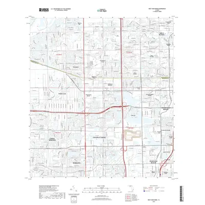
2018 Map of West Dixie Bend
USGS Topo · Published 2018About this map
Coconut Creek and the surrounding suburban expansion of Northern Broward County are meticulously documented in this 2018 survey. The landscape is defined by the Hillsboro Canal, which serves as a major geographical divider near the Palm Beach Co Broward Co line. Residential developments such as Sandalfoot Cove and Boca Del Mar highlight the dense growth pattern that characterizes this part of South Florida. Further south, the map details the established neighborhoods of Margate and Pompano Beach, including the Florida College of Natural Health and Sailboat Lake. For those researching local development or family locations, the map identifies specific community enclaves like Carver Village, Sanders Park, and the Eternal Light Memorial Gardens. The road network is dominated by the Sawgrass Expy and Hillsboro Blvd, illustrating the infrastructure connecting these many distinct settlements.
Find a feature on this map
42 named features on this map. Tap any name to fly to it.
Don’t see what you’re looking for? This feature index may not catch every label — zoom into the map to look around manually.
Map Details
Editions of this 2018 West Dixie Bend Map
This is the sole edition of this map. No revisions or reprints were ever made.
Other maps of this area

1945 · Fort Lauderdale North
USGS Topo · 1:24,000

1946 · West Dixie Bend
USGS Topo · 1:24,000

1946 · Boca Raton
USGS Topo · 1:24,000

1947 · Delmar Farms
USGS Topo · 1:24,000

1949 · Fort Lauderdale North
USGS Topo · 1:24,000

1949 · West Dixie Bend
USGS Topo · 1:24,000

1949 · Pompano Beach
USGS Topo · 1:24,000

1949 · Delmar Farms
USGS Topo · 1:24,000

1950 · Boca Raton
USGS Topo · 1:24,000

1950 · Delray Beach
USGS Topo · 1:24,000