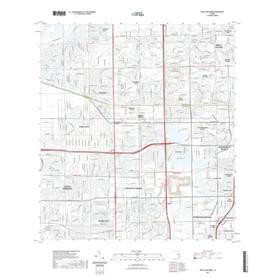
2021 Map of West Dixie Bend
USGS Topo · Published 2021About this map
The boundary between Palm Beach and Broward Counties defines this modern coastal landscape, where the dense suburban grids of South Florida meet the edge of the Everglades. This map documents a complex network of planned communities and incorporated cities, including Parkland, Coconut Creek, and Boca Raton. A sophisticated system of water management is visible through the prominent Hillsboro Canal and numerous artificial water bodies like Sailboat Lake and Crystal Lake. Large-scale public spaces such as Quiet Waters Park and Tradewinds Regional Park are interspersed among residential developments like Sandalfoot Cove and Paradise Palms. The presence of the Westview Community Cem and University Park highlights the established infrastructure of this high-density region. Key transportation corridors, including the Sawgrass Expressway, facilitate the continuous sprawl that connects these once-distinct municipalities.
Find a feature on this map
42 named features on this map. Tap any name to fly to it.
Don’t see what you’re looking for? This feature index may not catch every label — zoom into the map to look around manually.
Map Details
Editions of this 2021 West Dixie Bend Map
This is the sole edition of this map. No revisions or reprints were ever made.
Other maps of this area

1945 · Fort Lauderdale North
USGS Topo · 1:24,000

1946 · West Dixie Bend
USGS Topo · 1:24,000

1946 · Boca Raton
USGS Topo · 1:24,000

1947 · Delmar Farms
USGS Topo · 1:24,000

1949 · Fort Lauderdale North
USGS Topo · 1:24,000

1949 · West Dixie Bend
USGS Topo · 1:24,000

1949 · Pompano Beach
USGS Topo · 1:24,000

1949 · Delmar Farms
USGS Topo · 1:24,000

1950 · Boca Raton
USGS Topo · 1:24,000

1950 · Delray Beach
USGS Topo · 1:24,000