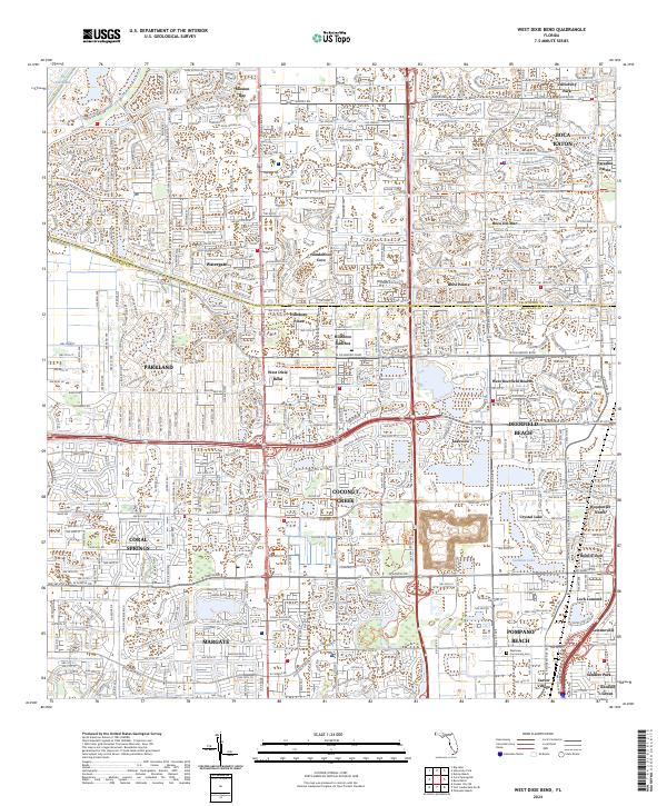
2024 Map of West Dixie Bend
USGS Topo · Published 2024About this map
Arthur R Marshall Loxahatchee National Wildlife Refuge marks the northwestern boundary of this South Florida region, where the managed conservation land meets the dense residential expansion of northern Broward and southern Palm Beach counties. The Hillsboro Canal acts as a primary hydrological and political artery, separating Parkland and Coconut Creek from the developed communities of Boca Raton and Sandalfoot Cove. This modern landscape is defined by its intricate network of master-planned neighborhoods such as Boca Pointe and Watergate, alongside recreational features like the Coconut Creek Trails. The map documents a highly urbanized era, yet the proximity to The Everglades remains a constant presence. Local history and genealogy interests are served by the location of the Westview Community Cem and the specific naming of smaller enclaves like West Dixie Bend and Hillsboro Ranches.
Find a feature on this map
38 named features on this map. Tap any name to fly to it.
Don’t see what you’re looking for? This feature index may not catch every label — zoom into the map to look around manually.
Map Details
Editions of this 2024 West Dixie Bend Map
This is the sole edition of this map. No revisions or reprints were ever made.
Other maps of this area

1945 · Fort Lauderdale North
USGS Topo · 1:24,000

1946 · West Dixie Bend
USGS Topo · 1:24,000

1946 · Boca Raton
USGS Topo · 1:24,000

1947 · Delmar Farms
USGS Topo · 1:24,000

1949 · Fort Lauderdale North
USGS Topo · 1:24,000

1949 · West Dixie Bend
USGS Topo · 1:24,000

1949 · Pompano Beach
USGS Topo · 1:24,000

1949 · Delmar Farms
USGS Topo · 1:24,000

1950 · Boca Raton
USGS Topo · 1:24,000

1950 · Delray Beach
USGS Topo · 1:24,000