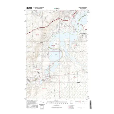
2016 Map of West Duluth
USGS Topo · Published 2016About this map
The Saint Louis River corridor serves as the industrial and geographic spine of this border region, separating Duluth, Minnesota, from Superior, Wisconsin. The map captures the complex waterfront where the river widens into Saint Louis Bay, dotted with significant landforms like Clough Island and Spirit Island. Inland, the terrain rises toward Bardon Peak, overlooking a dense network of industrial neighborhoods and planned communities. The legacy of heavy industry is visible in the layout of Morgan Park, Steelton, and New Duluth, which were established to support the nearby mills and manufacturing centers. Transportation is a dominant theme, with the Duluth Missabe and Iron Range RR threading through the river valley and multiple crossings like the Bong Bridge and the Old Oliver Bridge linking the two states. Cultural sites such as Oneota Cem and Duluth Business Univ reflect the long-standing civic foundations of the harbor city.
Find a feature on this map
58 named features on this map. Tap any name to fly to it.
Don’t see what you’re looking for? This feature index may not catch every label — zoom into the map to look around manually.
Map Details
Editions of this 2016 West Duluth Map
This is the sole edition of this map. No revisions or reprints were ever made.
Other maps of this area

1895 · Duluth
USGS Topo · 1:62,500

1915 · Superior
USGS Topo · 1:48,000

1917 · Superior
USGS Topo · 1:62,500

1953 · Adolph
USGS Topo · 1:24,000

1953 · Duluth
USGS Topo · 1:24,000

1953 · Duluth Heights
USGS Topo · 1:24,000

1953 · Duluth
USGS Topo · 1:62,500

1953 · Duluth
USGS Topo · 1:250,000

1954 · West Duluth
USGS Topo · 1:24,000

1954 · Borea
USGS Topo · 1:24,000