
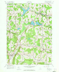
1943 Map of West Eaton
USGS Topo · Published 1960About this map
West Eaton and the surrounding township of Eaton define this mid-century landscape of Madison County, shaped by upland reservoirs and narrow valley settlements. The terrain is marked by distinctive heights like Jackass Hill and Texas Hill, while the local economy is traced through the path of the Otselic River and the small hamlet of Georgetown Sta. Genealogists will find notable value in the location of the Hawk Cem and Niles Cem, alongside rural landmarks like School No 1. The map documents a system of water management including the Eaton Reservoir, Bradley Brook Reservoir, and Hatch Lake, which sit atop the hills to provide a controlled descent of water to the valleys below. These features, combined with the scattered farmsteads and crossing brooks like Lebanon Brook, illustrate the rural structure of Central New York during the early 1940s.
Find a feature on this map
26 named features on this map. Tap any name to fly to it.
Don’t see what you’re looking for? This feature index may not catch every label — zoom into the map to look around manually.
Map Details
Editions of this 1943 West Eaton Map
2 editions found
Other maps of this area

1897 · Cazenovia
USGS Topo · 1:62,500

1899 · Cazenovia
USGS Topo · 1:62,500

1902 · Morrisville
USGS Topo · 1:62,500

1903 · Norwich
USGS Topo · 1:62,500

1904 · Pitcher
USGS Topo · 1:62,500

1943 · Otselic
USGS Topo · 1:24,000
1943 · Cazenovia
USGS Topo · 1:24,000

1943 · Morrisville
USGS Topo · 1:24,000

1943 · South Ostelic
USGS Topo · 1:24,000
1943 · Erieville
USGS Topo · 1:24,000