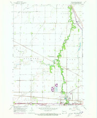
1959 Map of West Fargo
USGS Topo · Published 1973About this map
The Sheyenne River meanders sharply through the Red River Valley in this mid-century survey, creating a lush corridor of green amidst the structured grid of Cass County. To the south, the rail-driven growth of West Fargo and South West Fargo is prominent along the Burlington Northern line, which also passes through smaller points like Fife and Pinkham. This era shows the landscape in transition, with established local landmarks like the Harwood Sch and Maple-Sheyenne Ch serving dispersed farming communities while newer infrastructure, including the Radio Towers (WDAY) and Sewage Disposal works, reflects expanding regional utility.
Find a feature on this map
30 named features on this map. Tap any name to fly to it.
Don’t see what you’re looking for? This feature index may not catch every label — zoom into the map to look around manually.
Map Details
Editions of this 1959 West Fargo Map
3 editions found

Other maps of this area

1895 · Fargo
USGS Topo · 1:125,000

1895 · Casselton
USGS Topo · 1:125,000

1897 · Fargo
USGS Topo · 1:125,000

1897 · Casselton
USGS Topo · 1:125,000

1952 · Grand Forks
USGS Topo · 1:250,000

1953 · Fargo
USGS Topo · 1:250,000

1956 · Fargo
USGS Topo · 1:250,000

1956 · Grand Forks
USGS Topo · 1:250,000

1959 · Fargo North
USGS Topo · 1:24,000

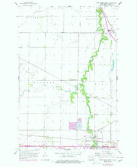
1959 · South West Fargo
USGS Topo · 1:24,000