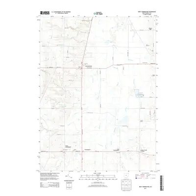
2013 Map of West Farmington
USGS Topo · Published 2013About this map
The Grand River snakes through this Trumbull County landscape, defining a network of small agricultural settlements and family holdings in the early twenty-first century. Mesopotamia and West Farmington serve as the primary hubs, connected by a grid of rural routes including State Route 534 and Oh-88. The map documents a deeply rooted community, where local heritage is preserved in sites like Hillside Cemetery and Fairview Cemetery.
Find a feature on this map
57 named features on this map. Tap any name to fly to it.
Don’t see what you’re looking for? This feature index may not catch every label — zoom into the map to look around manually.
Map Details
Editions of this 2013 West Farmington Map
This is the sole edition of this map. No revisions or reprints were ever made.
Other maps of this area

1904 · Chardon
USGS Topo · 1:62,500

1905 · Bristolville
USGS Topo · 1:62,500

1905 · Garrettsville
USGS Topo · 1:62,500

1905 · Jefferson
USGS Topo · 1:62,500

1906 · Chardon
USGS Topo · 1:62,500

1907 · Bristolville
USGS Topo · 1:62,500

1907 · Jefferson
USGS Topo · 1:62,500

1907 · Garrettsville
USGS Topo · 1:62,500

1950 · Cleveland
USGS Topo · 1:250,000

1952 · West Farmington
USGS Topo · 1:24,000
Featured Places
- Mesopotamia, Mesopotamia Township
- Mesopotamia Township, OH
- Farmington, Farmington Township
- Farmington Township, OH
- Bloomfield Township, OH