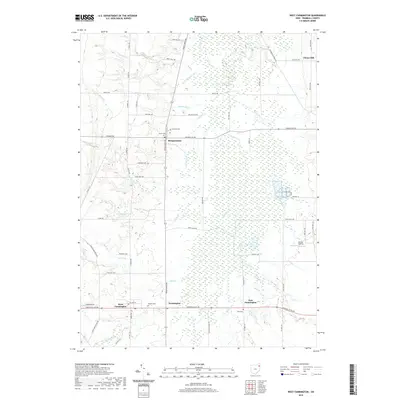
2019 Map of West Farmington
USGS Topo · Published 2019About this map
Mesopotamia and the surrounding township are defined by a dense network of local creeks and small settlements in this 2019 survey of Trumbull County. The landscape is heavily marked by water, with the Grand River and its numerous tributaries including Garden Cr, Mill Cr, and Swine Cr draining the agricultural and wooded terrain. Genealogy researchers will find several local burial grounds documented, such as Fairview Cem near the center of the township and Hillside Cem and East Cem clustered near the southern settlements of Farmington and West Farmington.
Find a feature on this map
64 named features on this map. Tap any name to fly to it.
Don’t see what you’re looking for? This feature index may not catch every label — zoom into the map to look around manually.
Map Details
Editions of this 2019 West Farmington Map
This is the sole edition of this map. No revisions or reprints were ever made.
Other maps of this area

1904 · Chardon
USGS Topo · 1:62,500

1905 · Bristolville
USGS Topo · 1:62,500

1905 · Garrettsville
USGS Topo · 1:62,500

1905 · Jefferson
USGS Topo · 1:62,500

1906 · Chardon
USGS Topo · 1:62,500

1907 · Bristolville
USGS Topo · 1:62,500

1907 · Jefferson
USGS Topo · 1:62,500

1907 · Garrettsville
USGS Topo · 1:62,500

1950 · Cleveland
USGS Topo · 1:250,000

1952 · West Farmington
USGS Topo · 1:24,000
Featured Places
- Mesopotamia, Mesopotamia Township
- Mesopotamia Township, OH
- Farmington, Farmington Township
- Farmington Township, OH
- Bloomfield Township, OH