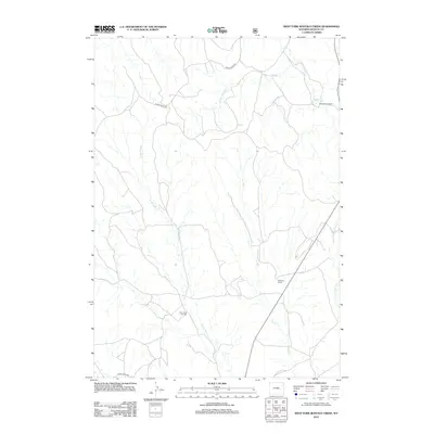
2012 Map of West Fork Buffalo Creek
USGS Topo · Published 2012About this map
Hay Creek Oil Field and scattered ranching operations define this Weston County landscape during the early 21st century. The drainage patterns of the W Fork Buffalo Cr and W Fork Hay Cr dictate the layout of the region's limited transportation network, most notably Raven Creek Rd which cuts through the northern and western sections of the quadrangle. The map documents long-standing land holdings such as the Shepperson Ranch in the northeast and Hoffman Ranch further south. This survey illustrates the specialized infrastructure of Wyoming's energy sector and the enduring presence of large-scale ranching in an area where water sources like Buffalo Cr and Hay Cr remain the primary geographical anchors for settlement and industry.
Find a feature on this map
9 named features on this map. Tap any name to fly to it.
Don’t see what you’re looking for? This feature index may not catch every label — zoom into the map to look around manually.
Map Details
Editions of this 2012 West Fork Buffalo Creek Map
This is the sole edition of this map. No revisions or reprints were ever made.
Other maps of this area

1918 · Moorcroft
USGS Topo · 1:125,000

1954 · Gillette
USGS Topo · 1:250,000

1955 · Newcastle
USGS Topo · 1:250,000

1955 · Gillette
USGS Topo · 1:250,000

1957 · Upton
USGS Topo · 1:62,500

1958 · Gillette
USGS Topo · 1:250,000

1958 · Newcastle
USGS Topo · 1:250,000

1962 · Gillette
USGS Topo · 1:250,000

1979 · Newcastle
USGS Topo · 1:100,000

1979 · Sundance
USGS Topo · 1:100,000