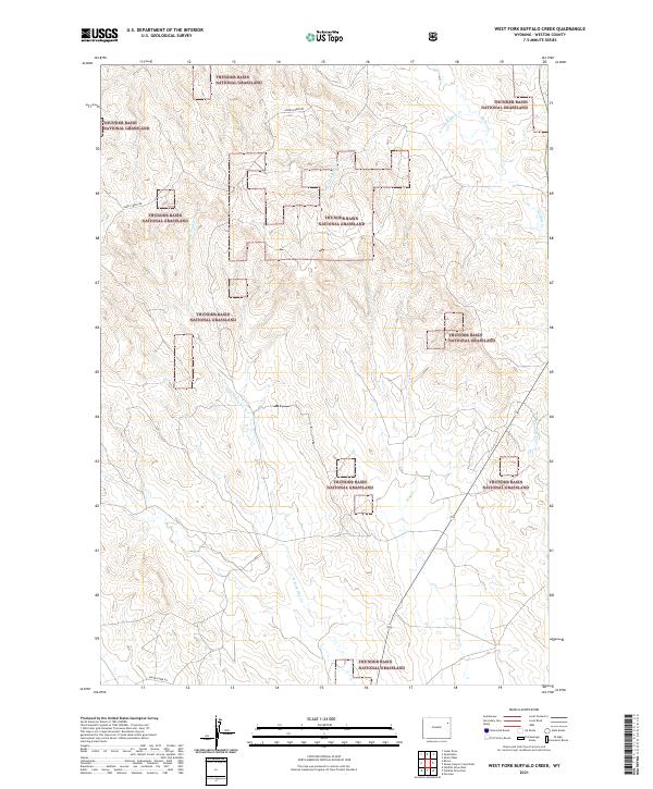
2021 Map of West Fork Buffalo Creek
USGS Topo · Published 2021About this map
Thunder Basin National Grassland dominates this high-plains landscape in Weston County, where a network of ephemeral drainages carves through the shortgrass prairie. The hydrology of the region is defined by the branching headwaters of the Buffalo Creek and Hay Creek systems, including the W Fork Buffalo Cr and E Fork Hay Cr. These creek beds illustrate the complex natural drainage patterns required to manage seasonal runoff in a semi-arid environment. Human presence is marked primarily by the section lines of the Public Land Survey System, such as t46n r67w and t45n r66w, and the winding route of Raven Creek Rd. The map reveals a land utilized for large-scale conservation and grazing, with the sparse infrastructure characteristic of Wyoming's expansive open range.
Find a feature on this map
11 named features on this map. Tap any name to fly to it.
Don’t see what you’re looking for? This feature index may not catch every label — zoom into the map to look around manually.
Map Details
Editions of this 2021 West Fork Buffalo Creek Map
This is the sole edition of this map. No revisions or reprints were ever made.
Other maps of this area

1918 · Moorcroft
USGS Topo · 1:125,000

1954 · Gillette
USGS Topo · 1:250,000

1955 · Newcastle
USGS Topo · 1:250,000

1955 · Gillette
USGS Topo · 1:250,000

1957 · Upton
USGS Topo · 1:62,500

1958 · Gillette
USGS Topo · 1:250,000

1958 · Newcastle
USGS Topo · 1:250,000

1962 · Gillette
USGS Topo · 1:250,000

1979 · Newcastle
USGS Topo · 1:100,000

1979 · Sundance
USGS Topo · 1:100,000