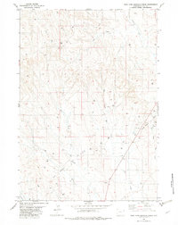
1982 Map of West Fork Buffalo Creek
USGS Topo · Published 1982About this map
The Fiddler Creek Oil Field dominates this 1982 map of the Wyoming high plains, showing a landscape defined by energy extraction and drainage networks. The terrain is marked by numerous Oil Wells and Drill Holes, particularly concentrated in the southeastern portion of the quadrangle. These industrial markings overlay a complex system of seasonal watercourses, including West Fork Buffalo Creek and Hay Creek. A single Radio Tower stands as a prominent man-made landmark amidst the undulating drainage divides of Lone Tree Cr and East Fork Hay Creek. The map documents a period when the local economy was heavily integrated with petroleum exploration, revealing the specific locations of active wells and exploration sites across the Weston County landscape during the early 1980s.
Find a feature on this map
9 named features on this map. Tap any name to fly to it.
Don’t see what you’re looking for? This feature index may not catch every label — zoom into the map to look around manually.
Map Details
Editions of this 1982 West Fork Buffalo Creek Map
This is the sole edition of this map. No revisions or reprints were ever made.
Other maps of this area

1918 · Moorcroft
USGS Topo · 1:125,000

1954 · Gillette
USGS Topo · 1:250,000

1955 · Newcastle
USGS Topo · 1:250,000

1955 · Gillette
USGS Topo · 1:250,000

1957 · Upton
USGS Topo · 1:62,500

1958 · Gillette
USGS Topo · 1:250,000

1958 · Newcastle
USGS Topo · 1:250,000

1962 · Gillette
USGS Topo · 1:250,000

1979 · Newcastle
USGS Topo · 1:100,000

1979 · Sundance
USGS Topo · 1:100,000