
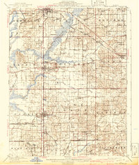
1909 Map of West Frankfort
USGS Topo · Published 1909About this map
Benton and West Frankfort serve as central nodes in this early 20th-century landscape, which is heavily defined by a burgeoning rail network during the region's industrial expansion. The Chicago and Eastern Illinois RR and the St Louis and Eldorado Line cut across the territory, connecting established coal-country towns like Johnston City and Parrish. The map reveals a dense rural infrastructure where small settlements such as Smothersville and Deering City are supported by a network of local institutions, including the Mormon Church, Williams Prairie Church, and Coon Ridge School.
Find a feature on this map
76 named features on this map. Tap any name to fly to it.
Don’t see what you’re looking for? This feature index may not catch every label — zoom into the map to look around manually.
Map Details
Editions of this 1909 West Frankfort Map
2 editions found
Other maps of this area

1908 · Galatia
USGS Topo · 1:62,500

1910 · Herrin
USGS Topo · 1:62,500

1922 · Carbondale
USGS Topo · 1:62,500

1925 · Marion
USGS Topo · 1:62,500

1925 · Harrisburg
USGS Topo · 1:62,500

1926 · Duquoin
USGS Topo · 1:62,500

1936 · Herrin
USGS Topo · 1:62,500

1938 · Galatia
USGS Topo · 1:62,500

1939 · Ina
USGS Topo · 1:62,500

1939 · Harrisburg
USGS Topo · 1:62,500