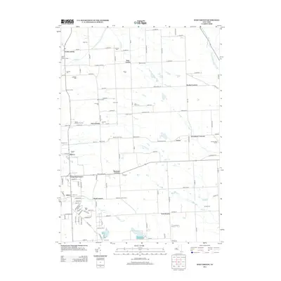
2013 Map of West Groton
USGS Topo · Published 2013About this map
West Dryden and North Lansing define a landscape of dispersed agricultural hamlets and family farmsteads in the early 21st century. The region is marked by a high density of small cemeteries, such as Stearns Cem and the Cobb Street Cem, which reflect the long-standing family lineages of Tompkins County. The mapping includes many distinctive crossroads and property names like Ludlow Corners and Terpening Corners, alongside specialized operations such as Sandyside Dairy and Moore's Christmas Tree Farm. Waterways like Owasco Inlet and Hemlock Cr drain the area, while the topography rises to points like Bean Hill and Lobdell Hill. This survey highlights the preservation of traditional rural boundaries even as contemporary residential developments like Bakers Acres of North Lansing begin to emerge near established hubs such as East Lansing.
Find a feature on this map
93 named features on this map. Tap any name to fly to it.
Don’t see what you’re looking for? This feature index may not catch every label — zoom into the map to look around manually.
Map Details
Editions of this 2013 West Groton Map
This is the sole edition of this map. No revisions or reprints were ever made.
Other maps of this area

1893 · Ithaca
USGS Topo · 1:62,500

1895 · Ithaca
USGS Topo · 1:62,500

1898 · Moravia
USGS Topo · 1:62,500

1900 · Dryden
USGS Topo · 1:62,500

1902 · Moravia
USGS Topo · 1:62,500

1902 · Genoa
USGS Topo · 1:62,500

1905 · Watkins Glen
USGS Topo · 1:125,000

1906 · Catatonk
USGS Topo · 1:125,000

1942 · Ludlowville
USGS Topo · 1:24,000

1942 · Groton
USGS Topo · 1:24,000