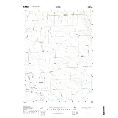
2019 Map of West Groton
USGS Topo · Published 2019About this map
North Lansing and East Lansing anchor the western portion of this rural landscape where Tompkins and Cayuga counties meet. The area is defined by a dense network of small hamlets and agricultural crossroads, including West Groton, Mosher Corners, and Grotto. These settlements are interspersed with numerous family and community burial grounds such as Miller Cem, Lanterman Cem, and the Cobb Street Cem, providing a significant record of local heritage. The terrain transitions from the heights of Lobdell Hill and Bean Hill down toward the Owasco Inlet in the northeast and Bear Swamp in the center. Tributaries like Hemlock Cr and Mill Cr drain the fields between longstanding landmarks like Terpening Corners and Head Corners, illustrating a persistent 19th-century settlement pattern that remains visible in the modern road network.
Find a feature on this map
112 named features on this map. Tap any name to fly to it.
Don’t see what you’re looking for? This feature index may not catch every label — zoom into the map to look around manually.
Map Details
Editions of this 2019 West Groton Map
This is the sole edition of this map. No revisions or reprints were ever made.
Other maps of this area

1893 · Ithaca
USGS Topo · 1:62,500

1895 · Ithaca
USGS Topo · 1:62,500

1898 · Moravia
USGS Topo · 1:62,500

1900 · Dryden
USGS Topo · 1:62,500

1902 · Moravia
USGS Topo · 1:62,500

1902 · Genoa
USGS Topo · 1:62,500

1905 · Watkins Glen
USGS Topo · 1:125,000

1906 · Catatonk
USGS Topo · 1:125,000

1942 · Ludlowville
USGS Topo · 1:24,000

1942 · Groton
USGS Topo · 1:24,000