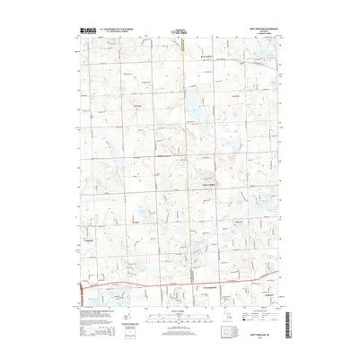
2014 Map of West Highland
USGS Topo · Published 2014About this map
West Highland and the surrounding charter townships of Oakland and Livingston Counties are defined by a complex glacial topography of kettle lakes and rolling hills. This 2014 survey captures the persistent rural-residential character of the region, where crossroads settlements like Rose Corners, Hallers Corners, and Hickory Ridge anchor a landscape dotted with significant water bodies including Dunham Lake, Tipsico Lake, and Highland Lake. The map details a transition from the agricultural heritage found along Clyde Rd and Faussett Rd to the suburban expansion near Hartland and Highland. Genealogists will find the locations of several historic burial grounds, such as Beebe Cem and Hodge Cem, which remain as markers of the area's early families. The drainage of N Ore Cr and the clustering of lakes like Big School Lot Lake and Little School Lot Lake illustrate the unique hydrography that has shaped local development and recreation for over a century.
Find a feature on this map
120 named features on this map. Tap any name to fly to it.
Don’t see what you’re looking for? This feature index may not catch every label — zoom into the map to look around manually.
Map Details
Editions of this 2014 West Highland Map
This is the sole edition of this map. No revisions or reprints were ever made.
Other maps of this area

1907 · Howell
USGS Topo · 1:62,500

1909 · Howell
USGS Topo · 1:62,500

1909 · Milford
USGS Topo · 1:62,500

1920 · Holly
USGS Topo · 1:62,500

1922 · Holly
USGS Topo · 1:62,500

1922 · Durand
USGS Topo · 1:62,500

1936 · Wixom
USGS Topo · 1:31,680

1936 · Highland
USGS Topo · 1:31,680

1942 · Highland
USGS Topo · 1:24,000

1943 · Holly
USGS Topo · 1:62,500
Featured Places
- Highland Charter Township, MI
- Hartland Township, MI
- Tyrone Township, MI
- Rose Corners, MI
- Hickory Ridge, Highland Charter Township