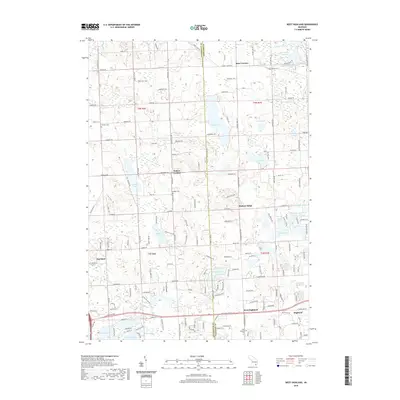
2019 Map of West Highland
USGS Topo · Published 2019About this map
The boundary between Livingston Co and Oakland Co divides this lake-dotted portion of Highland Charter Township, showing a landscape defined by glacial kettle lakes and small unincorporated settlements. In the northern reaches, the community of Rose Corners sits near the family-named Beebe Cem, while further south, Hallers Corners and Hickory Ridge mark key road intersections. The township's history is reflected in the diverse names of its water bodies, including Big School Lot Lake and Little School Lot Lake, which indicate early land use and public school fund allotments. Near the southern edge, West Highland and the West Highland Cem represent established centers of local life. The map details a dense network of residential development surrounding major basins like Tipsico Lake, Whalen Lake, and Dunham Lake, illustrating the post-war transition from rural agricultural land to a lakefront residential community.
Find a feature on this map
166 named features on this map. Tap any name to fly to it.
Don’t see what you’re looking for? This feature index may not catch every label — zoom into the map to look around manually.
Map Details
Editions of this 2019 West Highland Map
This is the sole edition of this map. No revisions or reprints were ever made.
Other maps of this area

1907 · Howell
USGS Topo · 1:62,500

1909 · Howell
USGS Topo · 1:62,500

1909 · Milford
USGS Topo · 1:62,500

1920 · Holly
USGS Topo · 1:62,500

1922 · Holly
USGS Topo · 1:62,500

1922 · Durand
USGS Topo · 1:62,500

1936 · Wixom
USGS Topo · 1:31,680

1936 · Highland
USGS Topo · 1:31,680

1942 · Highland
USGS Topo · 1:24,000

1943 · Holly
USGS Topo · 1:62,500
Featured Places
- Highland Charter Township, MI
- Hartland Township, MI
- Tyrone Township, MI
- Rose Corners, MI
- Hickory Ridge, Highland Charter Township