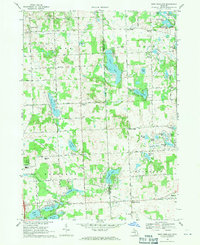
1968 Map of West Highland
USGS Topo · Published 1971About this map
Tyrone Center and Rose Corners anchor the northern reaches of this landscape where the boundaries of Tyrone, Rose, Hartland, and Highland townships converge. The area is defined by an intricate network of glacial kettle lakes and marshes, ranging from the large Tipsico Lake to the smaller Big School Lot Lake. This 1960s-era geography shows a transition from rural agricultural land toward recreational and residential development, evidenced by Fair Haven Camp and a YMCA Camp nestled along the shorelines.
Find a feature on this map
71 named features on this map. Tap any name to fly to it.
Don’t see what you’re looking for? This feature index may not catch every label — zoom into the map to look around manually.
Map Details
Editions of this 1968 West Highland Map
3 editions found
Other maps of this area

1907 · Howell
USGS Topo · 1:62,500

1909 · Howell
USGS Topo · 1:62,500

1909 · Milford
USGS Topo · 1:62,500

1920 · Holly
USGS Topo · 1:62,500

1922 · Holly
USGS Topo · 1:62,500

1922 · Durand
USGS Topo · 1:62,500

1936 · Wixom
USGS Topo · 1:31,680

1936 · Highland
USGS Topo · 1:31,680

1942 · Highland
USGS Topo · 1:24,000

1943 · Holly
USGS Topo · 1:62,500
Featured Places
- Highland Charter Township, MI
- Hartland Township, MI
- Tyrone Township, MI
- Hickory Ridge, Highland Charter Township
- Rose Township, MI