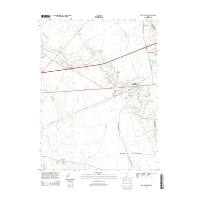
2013 Map of West Jefferson
USGS Topo · Published 2013About this map
West Jefferson serves as the primary hub of this Madison County landscape, where the historic National Pike and Us-40 intersect the local road network. The map reveals a transition from the concentrated residential streets of the village to the expansive agricultural tracts that define the region. Family-named operations like Miller Farms, Salyers Farm, and Morning Star Morgan Farm emphasize the enduring rural economy of central Ohio. To the south, the smaller settlement of Lilly Chapel sits near the crossing of Oh-665 and Oh-142.
Find a feature on this map
67 named features on this map. Tap any name to fly to it.
Don’t see what you’re looking for? This feature index may not catch every label — zoom into the map to look around manually.
Map Details
Editions of this 2013 West Jefferson Map
This is the sole edition of this map. No revisions or reprints were ever made.
Other maps of this area

1901 · Dublin
USGS Topo · 1:62,500

1903 · Dublin
USGS Topo · 1:62,500

1907 · London
USGS Topo · 1:62,500

1916 · Milford Center
USGS Topo · 1:62,500

1923 · West Columbus
USGS Topo · 1:62,500

1925 · West Columbus
USGS Topo · 1:62,500

1944 · Milford Center
USGS Topo · 1:62,500

1947 · Columbus
USGS Topo · 1:250,000

1950 · Marion
USGS Topo · 1:250,000
1954 · Hilliard
USGS Topo · 1:24,000