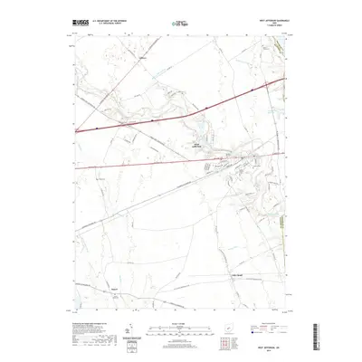
2019 Map of West Jefferson
USGS Topo · Published 2019About this map
West Jefferson sits at a historic crossroads in Madison County, where the historic National Pike and W Broad St intersect a landscape defined by agricultural drainage and natural waterways. This 2019 survey captures the village's modern footprint alongside the surrounding rural hamlets of Gillivan, Lilly Chapel, and Rupert. The terrain is marked by an extensive network of engineered waterways, including the Monroe Bidwell Ditch, Bridenstine Ditch, and Sultana Wilson Ditch, which support the region's long-standing farming tradition.
Find a feature on this map
66 named features on this map. Tap any name to fly to it.
Don’t see what you’re looking for? This feature index may not catch every label — zoom into the map to look around manually.
Map Details
Editions of this 2019 West Jefferson Map
This is the sole edition of this map. No revisions or reprints were ever made.
Other maps of this area

1901 · Dublin
USGS Topo · 1:62,500

1903 · Dublin
USGS Topo · 1:62,500

1907 · London
USGS Topo · 1:62,500

1916 · Milford Center
USGS Topo · 1:62,500

1923 · West Columbus
USGS Topo · 1:62,500

1925 · West Columbus
USGS Topo · 1:62,500

1944 · Milford Center
USGS Topo · 1:62,500

1947 · Columbus
USGS Topo · 1:250,000

1950 · Marion
USGS Topo · 1:250,000
1954 · Hilliard
USGS Topo · 1:24,000