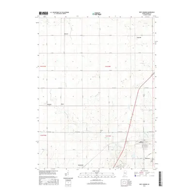
2016 Map of West Lebanon
USGS Topo · Published 2016About this map
West Lebanon and its neighboring agricultural hamlets anchor this portion of Warren County, where a network of section-line roads and state routes crisscrosses the fertile Indiana plains. The landscape is defined by its drainages, with Redwood Creek and its many tributaries, such as Mud Run and Foster Br, carving subtle paths through the township. These waterways have long dictated the placement of early settlements and rural burial grounds, including the Redwood Cem and Shankland Hill Cem. Small clusters of homes and farmsteads are concentrated near Stewart, Judyville, and Marshfield, reflecting the enduring rural character of the region. Significant landmarks like Old Town and the West Lebanon Cem offer touchpoints for local heritage, while the prominent corridor of N State Rd 63 provides a modern link through this traditional farming landscape.
Find a feature on this map
36 named features on this map. Tap any name to fly to it.
Don’t see what you’re looking for? This feature index may not catch every label — zoom into the map to look around manually.
Map Details
Editions of this 2016 West Lebanon Map
This is the sole edition of this map. No revisions or reprints were ever made.
Other maps of this area

1899 · Danville
USGS Topo · 1:62,500

1900 · Danville
USGS Topo · 1:62,500

1933 · Hoopeston
USGS Topo · 1:48,000

1938 · Hoopeston
USGS Topo · 1:62,500

1950 · Danville NE
USGS Topo · 1:24,000

1951 · Danville NE
USGS Topo · 1:24,000

1953 · Danville
USGS Topo · 1:250,000

1955 · Danville
USGS Topo · 1:250,000

1956 · Danville
USGS Topo · 1:250,000

1958 · Stonebluff
USGS Topo · 1:24,000