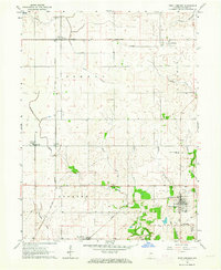
1958 Map of Stonebluff
USGS Topo · Published 1959About this map
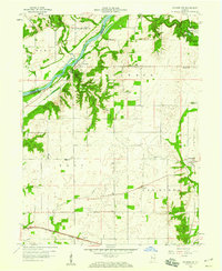
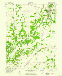
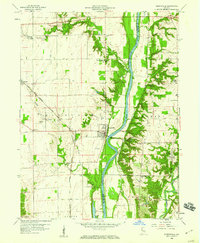
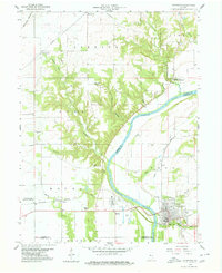
The Wabash River carves through the northwestern corner of this territory, where the dramatic Portland Arch terrain meets the banks near the small settlement of Fountain. The landscape is defined by a dense network of winding waterways, including Rattlesnake Creek, Bear Creek, and Marquess Creek, which cut deep ravines into the central plateau. In the late 1950s, this portion of Fountain County maintained a strictly rural character, anchored by community landmarks such as Osborn Prairie Ch and Salem Ch. Transportation history is visible in the divergent paths of the New York Central railroad and the N Y C & St L line near Stonebluff, alongside an Old Railroad Grade that speaks to earlier transit corridors. Small hamlets like Rob Roy, Henpeck, and Layton are scattered across the township divisions, preserving the mid-century layout of these agricultural communities.
Find a feature on this map
33 named features on this map. Tap any name to fly to it.
Don’t see what you’re looking for? This feature index may not catch every label — zoom into the map to look around manually.
Map Details
Editions of this 1958 Stonebluff Map
This is the sole edition of this map. No revisions or reprints were ever made.
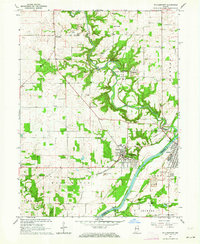
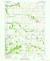
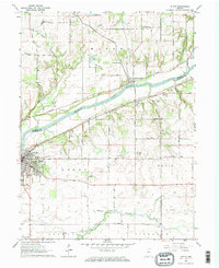
Other maps of this area

1953 · Danville
USGS Topo · 1:250,000

1955 · Danville
USGS Topo · 1:250,000

1956 · Danville
USGS Topo · 1:250,000
1958 · Veedersburg
USGS Topo · 1:24,000
1958 · Perrysville
USGS Topo · 1:24,000
1958 · Covington
USGS Topo · 1:24,000
1961 · West Lebanon
USGS Topo · 1:24,000
1962 · Williamsport
USGS Topo · 1:24,000
1962 · Mellott
USGS Topo · 1:24,000
1962 · Attica
USGS Topo · 1:24,000