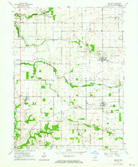
1962 Map of Mellott
USGS Topo · Published 1964About this map
Agricultural fields and small creek valleys define this corner of Fountain County in the early 1960s. The Chicago and Eastern Illinois railroad serves as a central artery, passing through the village of Mellott and the junction at Stephens Crossing. To the north, the historic settlement of Newtown is situated near several family and community landmarks, including the Newtown Cem and Hodson Cem.
Find a feature on this map
48 named features on this map. Tap any name to fly to it.
Don’t see what you’re looking for? This feature index may not catch every label — zoom into the map to look around manually.
Map Details
Editions of this 1962 Mellott Map
2 editions found
Other maps of this area

1953 · Danville
USGS Topo · 1:250,000

1955 · Danville
USGS Topo · 1:250,000

1956 · Danville
USGS Topo · 1:250,000

1958 · Stonebluff
USGS Topo · 1:24,000
1958 · Veedersburg
USGS Topo · 1:24,000

1962 · Williamsport
USGS Topo · 1:24,000
1962 · Waynetown
USGS Topo · 1:24,000
1962 · Westpoint
USGS Topo · 1:24,000
1962 · Attica
USGS Topo · 1:24,000
1962 · Wingate
USGS Topo · 1:24,000