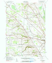
1943 Map of West Lowville
USGS Topo · Published 1990About this map
Lowville and its surrounding uplands appear here during the early 1940s, revealing a landscape defined by traditional rural education and local watercourses. The map traces a dense network of numbered schoolhouses, from School No 4 and School No 7 to School No 16, serving the dispersed farming communities in the townships of Harrisburg, Denmark, and Martinsburg. The topography transitions from the low-lying valley near the village to the higher elevations in the west, where settlements like Windecker and Harrisburg are situated among the headwaters of Stony Creek and Cobb Creek. Smaller hamlets like Briggs Corner and West Martinsburg punctuate the road network, while the placement of the Fairview Cem and Rural Cem provides valuable geographic markers for local family history research. This survey preserves the exact footprint of the New York dairy country before mid-century agricultural shifts began to consolidate these small rural districts.
Find a feature on this map
29 named features on this map. Tap any name to fly to it.
Don’t see what you’re looking for? This feature index may not catch every label — zoom into the map to look around manually.
Map Details
Editions of this 1943 West Lowville Map
3 editions found

Other maps of this area

1902 · Carthage
USGS Topo · 1:62,500

1904 · Carthage
USGS Topo · 1:62,500

1905 · Port Leyden
USGS Topo · 1:62,500

1906 · Highmarket
USGS Topo · 1:62,500

1907 · Port Leyden
USGS Topo · 1:62,500

1911 · Lowville
USGS Topo · 1:62,500

1913 · Lowville
USGS Topo · 1:62,500

1940 · Port Leyden
USGS Topo · 1:62,500

1942 · Copenhagen
USGS Topo · 1:24,000

1943 · Copenhagen
USGS Topo · 1:31,680