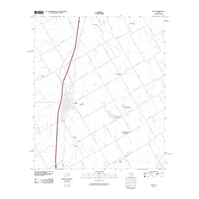
2010 Map of West
USGS Topo · Published 2010About this map
The agricultural landscape of central Texas is captured in this 2010 survey, centered on the historic Czech-heritage community of West. The map reveals a dense network of farm-to-market roads and named rural thoroughfares such as Willie Nelson Rd and Grady Calvery Dr, which connect the primary settlement to outlying areas like Cottonwood and Tours. Several water management structures, including the Soil Conservation Service Site 9 Dam and Galbraith Lake Dam, illustrate the vital role of local irrigation and flood control in this prairie environment. Genealogists will find significant value in the documentation of numerous burial sites, from the prominent Saint Mary's Cemetery and National Cemetery to the smaller Clausner Cemetery. The presence of Stapleton Field and West Airpark reflects the regional reliance on light aviation, while the winding courses of Rice Creek and Elm Creek define the natural drainage of the McLennan County terrain.
Find a feature on this map
71 named features on this map. Tap any name to fly to it.
Don’t see what you’re looking for? This feature index may not catch every label — zoom into the map to look around manually.
Map Details
Editions of this 2010 West Map
This is the sole edition of this map. No revisions or reprints were ever made.
Other maps of this area

1892 · Waco
USGS Topo · 1:125,000

1920 · Waco
USGS Topo · 1:125,000

1920 · Mart
USGS Topo · 1:62,500

1931 · Elm Mott
USGS Topo · 1:62,500

1954 · Waco
USGS Topo · 1:250,000

1955 · Waco
USGS Topo · 1:250,000

1956 · Penelope
USGS Topo · 1:24,000

1956 · Axtell
USGS Topo · 1:24,000

1956 · Abbott
USGS Topo · 1:24,000

1956 · West
USGS Topo · 1:24,000