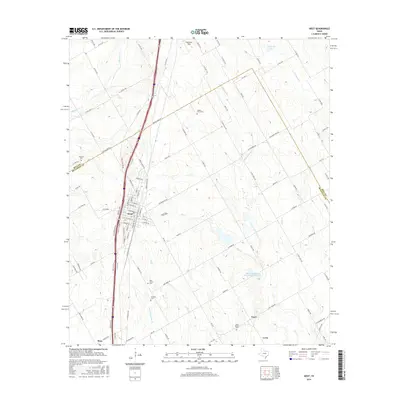
2016 Map of West
USGS Topo · Published 2016About this map
West serves as the primary hub of this McLennan County landscape, where the street grid is bisected by the Interstate 35 corridor. Local heritage is deeply rooted in the surrounding countryside, marked by several significant burial grounds including National Cem to the northwest and Saint Mary's Cem south of the main township. The map illustrates a transition from the structured residential blocks of the town to an expansive agricultural network drained by Cottonwood Cr, Rice Cr, and Elm Cr. To the southeast, smaller communities such as Tours and Leroy maintain their distinct identities, anchored by landmarks like Saint Martins Cem. Modern water management is evident through features like the Grade Stabilization Structure 103 Reservoir, which reflects the ongoing efforts to regulate the drainage basins of the Texas Blackland Prairies.
Find a feature on this map
111 named features on this map. Tap any name to fly to it.
Don’t see what you’re looking for? This feature index may not catch every label — zoom into the map to look around manually.
Map Details
Editions of this 2016 West Map
This is the sole edition of this map. No revisions or reprints were ever made.
Other maps of this area

1892 · Waco
USGS Topo · 1:125,000

1920 · Waco
USGS Topo · 1:125,000

1920 · Mart
USGS Topo · 1:62,500

1931 · Elm Mott
USGS Topo · 1:62,500

1954 · Waco
USGS Topo · 1:250,000

1955 · Waco
USGS Topo · 1:250,000

1956 · Penelope
USGS Topo · 1:24,000

1956 · Axtell
USGS Topo · 1:24,000

1956 · Abbott
USGS Topo · 1:24,000

1956 · West
USGS Topo · 1:24,000