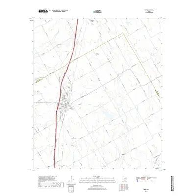
2019 Map of West
USGS Topo · Published 2019About this map
West serves as the primary hub of this Central Texas landscape, situated along the Hill Co and Mclennan Co boundary line. The town's grid is dense with residential and commercial streets, while the surrounding countryside is defined by a network of creeks, including Little Tehuacana Cr, Elm Cr, and Rice Cr. The rural character is punctuated by several significant burial sites, such as Saint Mary's Cem and Clausner Cem, reflecting the deep-rooted community history of the area.
Find a feature on this map
105 named features on this map. Tap any name to fly to it.
Don’t see what you’re looking for? This feature index may not catch every label — zoom into the map to look around manually.
Map Details
Editions of this 2019 West Map
This is the sole edition of this map. No revisions or reprints were ever made.
Other maps of this area

1892 · Waco
USGS Topo · 1:125,000

1920 · Waco
USGS Topo · 1:125,000

1920 · Mart
USGS Topo · 1:62,500

1931 · Elm Mott
USGS Topo · 1:62,500

1954 · Waco
USGS Topo · 1:250,000

1955 · Waco
USGS Topo · 1:250,000

1956 · Penelope
USGS Topo · 1:24,000

1956 · Axtell
USGS Topo · 1:24,000

1956 · Abbott
USGS Topo · 1:24,000

1956 · West
USGS Topo · 1:24,000