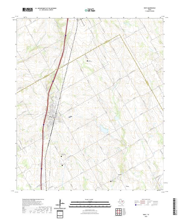
2022 Map of West
USGS Topo · Published 2022About this map
The city of West sits at the heart of this survey, positioned along a major transit corridor defined by I-35 SVC RD and Heritage Pkwy. The landscape is a network of agricultural land dissected by numerous waterways including Cottonwood Cr, Rice Cr, and Elm Cr. To the south, the smaller settlement of Leroy appears near the bank of Little Tehuacana Cr.
Find a feature on this map
108 named features on this map. Tap any name to fly to it.
Don’t see what you’re looking for? This feature index may not catch every label — zoom into the map to look around manually.
Map Details
Editions of this 2022 West Map
This is the sole edition of this map. No revisions or reprints were ever made.
Other maps of this area

1892 · Waco
USGS Topo · 1:125,000

1920 · Waco
USGS Topo · 1:125,000

1920 · Mart
USGS Topo · 1:62,500

1931 · Elm Mott
USGS Topo · 1:62,500

1954 · Waco
USGS Topo · 1:250,000

1955 · Waco
USGS Topo · 1:250,000

1956 · Penelope
USGS Topo · 1:24,000

1956 · Axtell
USGS Topo · 1:24,000

1956 · Abbott
USGS Topo · 1:24,000

1956 · West
USGS Topo · 1:24,000