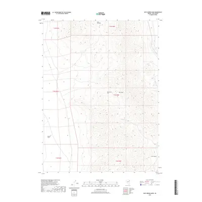
2018 Map of West Morris Basin
USGS Topo · Published 2018About this map
The Toano Range dominates this portion of Elko County, defining a landscape of high-elevation relief between several prominent terminal basins. The topographical data reveals the structural complexity of the Great Basin, where the West Morris Basin and Morris Basin sit east of the range, while the Silver Zone Basin extends to the north. Water sources are sparse in this high desert environment, making the location of Tunnel Spring a critical geographic marker for any history of land use or transit through the pass. To the west, the terrain descends into the broad expanse of the Goshute Valley, illustrating the classic basin-and-range formation that has historically dictated travel routes and grazing patterns in this corner of Nevada.
Find a feature on this map
12 named features on this map. Tap any name to fly to it.
Don’t see what you’re looking for? This feature index may not catch every label — zoom into the map to look around manually.
Map Details
Editions of this 2018 West Morris Basin Map
This is the sole edition of this map. No revisions or reprints were ever made.
Other maps of this area

1955 · Elko
USGS Topo · 1:250,000

1958 · Elko
USGS Topo · 1:250,000

1962 · Elko
USGS Topo · 1:250,000

1965 · Elko
USGS Topo · 1:250,000
1971 · Hardy Creek
USGS Topo · 1:24,000

1971 · West Morris Basin
USGS Topo · 1:24,000
1971 · Silver Zone Pass
USGS Topo · 1:24,000

1971 · Shafter
USGS Topo · 1:24,000

1971 · Pilot
USGS Topo · 1:24,000
1971 · Leppy Peak NW
USGS Topo · 1:24,000