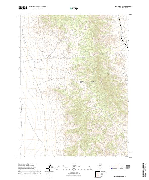
2021 Map of West Morris Basin
USGS Topo · Published 2021About this map
The Toano Range dominates this portion of Elko County, forming a high-relief spine between several distinct high-desert drainage areas. In this arid landscape, water sources are extremely localized, with Tunnel Spring serving as a notable point of interest on the eastern slopes. The topography is defined by the transition from the high peaks of the range down into the Silver Zone Basin to the north and the West Morris Basin and Morris Basin to the south. Along the western edge, the terrain levels out into the broad expanse of the Goshute Valley. This 2021 survey illustrates the complex public land survey system divisions across the region, showing the boundaries between t35n r67e, t34n r68e, and other townships that dictate land management in this part of Nevada.
Find a feature on this map
12 named features on this map. Tap any name to fly to it.
Don’t see what you’re looking for? This feature index may not catch every label — zoom into the map to look around manually.
Map Details
Editions of this 2021 West Morris Basin Map
This is the sole edition of this map. No revisions or reprints were ever made.
Other maps of this area

1955 · Elko
USGS Topo · 1:250,000

1958 · Elko
USGS Topo · 1:250,000

1962 · Elko
USGS Topo · 1:250,000

1965 · Elko
USGS Topo · 1:250,000
1971 · Hardy Creek
USGS Topo · 1:24,000

1971 · West Morris Basin
USGS Topo · 1:24,000
1971 · Silver Zone Pass
USGS Topo · 1:24,000

1971 · Shafter
USGS Topo · 1:24,000

1971 · Pilot
USGS Topo · 1:24,000
1971 · Leppy Peak NW
USGS Topo · 1:24,000