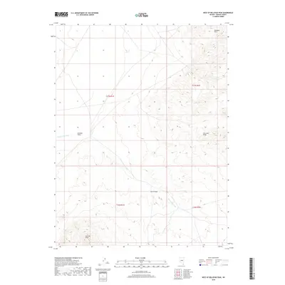
2018 Map of West of Bellevue Peak
USGS Topo · Published 2018About this map
Antelope Valley serves as a central drainage basin in this high-desert landscape of Eureka County, defined by the seasonal flow of Fenstermaker Wash. The terrain is steeply framed by the Mahogany Hills to the north and the Fish Creek Range to the east, illustrating the typical basin-and-range topography of central Nevada. The map details a network of 4WD trails and local roads that navigate the complex elevation changes between the valley floor and the Antelope Range. This U.S. Geological Survey topographic study documents the drainage patterns through Davis Canyon and the surrounding wilderness, where resource management and ranching tracks provide the only infrastructure. The absence of permanent settlements highlights the area's role as a vast rangeland and provides a clear record of the watershed and land-management boundaries in the late 2010s.
Find a feature on this map
10 named features on this map. Tap any name to fly to it.
Don’t see what you’re looking for? This feature index may not catch every label — zoom into the map to look around manually.
Map Details
Editions of this 2018 West of Bellevue Peak Map
This is the sole edition of this map. No revisions or reprints were ever made.
Other maps of this area

1926 · Roberts Mountains
USGS Topo · 1:250,000

1929 · Roberts Mountains
USGS Topo · 1:250,000

1955 · Millett
USGS Topo · 1:250,000

1956 · Bellevue Peak
USGS Topo · 1:62,500

1956 · Cockalorum Wash
USGS Topo · 1:62,500

1956 · Horse Heaven Mtn
USGS Topo · 1:62,500

1956 · Antelope Peak
USGS Topo · 1:62,500

1959 · Millett
USGS Topo · 1:250,000

1978 · Summit Mountain
USGS Topo · 1:100,000
1989 · Ninemile Peak
USGS Topo · 1:24,000