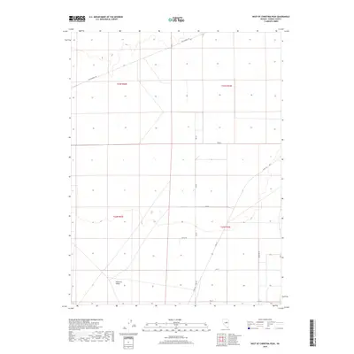
2018 Map of West of Christina Peak
USGS Topo · Published 2018About this map
Diamond Valley dominates this high-desert basin in Eureka County, revealing a landscape organized by both historic passage and modern grid-work. The legendary Pony Express Trl cuts across the northern reaches of the quadrangle, tracing the path of the short-lived but famous mail service through this arid terrain. Below this historic corridor, the map shows a shift toward rural development and systematic land use, defined by a network of numbered and named thoroughfares. Local routes such as Keg Rd, Moyle Dr, and Co Rd 101 service a sparse arrangement of properties and range land. The intersection of these modern local roads, like 19th St and Mustang St, against the backdrop of the broad valley floor illustrates the long-standing efforts to navigate and settle this segment of the Great Basin.
Find a feature on this map
15 named features on this map. Tap any name to fly to it.
Don’t see what you’re looking for? This feature index may not catch every label — zoom into the map to look around manually.
Map Details
Editions of this 2018 West of Christina Peak Map
This is the sole edition of this map. No revisions or reprints were ever made.
Other maps of this area

1926 · Roberts Mountains
USGS Topo · 1:250,000

1929 · Roberts Mountains
USGS Topo · 1:250,000

1949 · Garden Valley
USGS Topo · 1:62,500

1951 · Garden Valley
USGS Topo · 1:62,500

1953 · Eureka
USGS Topo · 1:62,500

1955 · Millett
USGS Topo · 1:250,000

1956 · Whistler Mtn
USGS Topo · 1:62,500

1956 · Ely
USGS Topo · 1:250,000

1957 · Diamond Springs
USGS Topo · 1:62,500

1959 · Ely
USGS Topo · 1:250,000