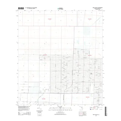
2015 Map of West of Delta
USGS Topo · Published 2015About this map
The Acreage defines this residential landscape in Palm Beach County, characterized by a massive grid of unpaved and paved roads that hint at the region's mid-century land development history. The map shows a transition from the structured street names of the residential area to the open wetlands of the north, where the Hungryland Slough Canal provides essential drainage for the low-lying terrain. To the south, the M Canal cuts a straight path through the landscape, marking a critical piece of water management infrastructure. Local history is reflected in the citrus-themed nomenclature of major thoroughfares like Key Lime Blvd, Orange Blvd, and Murcott Blvd. This 2015 survey captures a period of continued growth within the rural-residential enclave, showing the dense network of numbered streets such as 94th St N and 69th St N that fill the expansive grid.
Find a feature on this map
115 named features on this map. Tap any name to fly to it.
Don’t see what you’re looking for? This feature index may not catch every label — zoom into the map to look around manually.
Map Details
Editions of this 2015 West of Delta Map
This is the sole edition of this map. No revisions or reprints were ever made.
Other maps of this area

1945 · Delta
USGS Topo · 1:24,000

1946 · Palm Beach Farms
USGS Topo · 1:24,000

1948 · Rood
USGS Topo · 1:24,000

1949 · Rood
USGS Topo · 1:24,000

1949 · Palm Beach Farms
USGS Topo · 1:24,000

1950 · Delta
USGS Topo · 1:24,000

1956 · West Palm Beach
USGS Topo · 1:250,000

1957 · West Palm Beach
USGS Topo · 1:250,000

1958 · West Palm Beach
USGS Topo · 1:250,000

1970 · West Palm Beach 2 SW
USGS Topo · 1:24,000