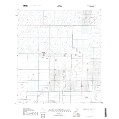
2018 Map of West of Delta
USGS Topo · Published 2018About this map
The Acreage and the developing community of Westlake represent a distinct pattern of residential growth in the Florida Everglades. This landscape is defined by its rectilinear grid of citrus-named thoroughfares, such as Citrus Grove Blvd, Key Lime Blvd, and Tangerine Blvd. These roads reflect the agricultural heritage and planned development of Palm Beach County, where large lot sizes and drainage networks predominate. To the north and east, the transition into Palm Beach Gardens is marked by the Hungryland Slough Canal and various water management features like the M Canal. The map also shows older routes like Stumpers Grade Rd and Windmill Rd, which contrast with the modern boulevard system. This 2018 survey captures a moment of rapid suburban expansion as former agricultural lands are integrated into the modern infrastructure of the metropolitan area.
Find a feature on this map
24 named features on this map. Tap any name to fly to it.
Don’t see what you’re looking for? This feature index may not catch every label — zoom into the map to look around manually.
Map Details
Editions of this 2018 West of Delta Map
This is the sole edition of this map. No revisions or reprints were ever made.
Other maps of this area

1945 · Delta
USGS Topo · 1:24,000

1946 · Palm Beach Farms
USGS Topo · 1:24,000

1948 · Rood
USGS Topo · 1:24,000

1949 · Rood
USGS Topo · 1:24,000

1949 · Palm Beach Farms
USGS Topo · 1:24,000

1950 · Delta
USGS Topo · 1:24,000

1956 · West Palm Beach
USGS Topo · 1:250,000

1957 · West Palm Beach
USGS Topo · 1:250,000

1958 · West Palm Beach
USGS Topo · 1:250,000

1970 · West Palm Beach 2 SW
USGS Topo · 1:24,000