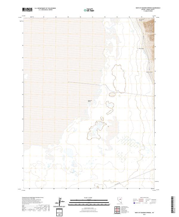
2021 Map of West of Diamond Springs
USGS Topo · Published 2021About this map
The Pony Express Trl cuts across the southern reach of this landscape, marking a path of significant western transit heritage where the valley floor meets the rising slopes. This high-desert basin is defined by the vast Diamond Valley, which stretches westward from the steep incline of the Diamond Mountains. These peaks dominate the eastern horizon, deeply incised by drainage features such as Box-Springs Canyon, Rock Canyon, and Willow Canyon.
Find a feature on this map
14 named features on this map. Tap any name to fly to it.
Don’t see what you’re looking for? This feature index may not catch every label — zoom into the map to look around manually.
Map Details
Editions of this 2021 West of Diamond Springs Map
This is the sole edition of this map. No revisions or reprints were ever made.
Other maps of this area

1926 · Roberts Mountains
USGS Topo · 1:250,000

1929 · Roberts Mountains
USGS Topo · 1:250,000

1934 · Jiggs
USGS Topo · 1:125,000

1937 · Mineral Hill
USGS Topo · 1:48,000

1937 · Jiggs
USGS Topo · 1:125,000

1943 · Mineral Hill
USGS Topo · 1:62,500

1949 · Garden Valley
USGS Topo · 1:62,500

1951 · Garden Valley
USGS Topo · 1:62,500

1955 · Millett
USGS Topo · 1:250,000

1955 · Winnemucca
USGS Topo · 1:250,000