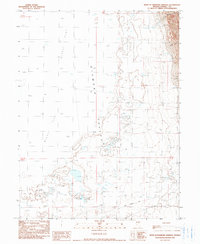
1990 Map of West of Diamond Springs
USGS Topo · Published 1990About this map
The historical Pony Express Trail cuts across the southern portion of this landscape, marking a vital corridor of nineteenth-century communication and travel through the high desert. This 1990 provisional map documents the basin floor of Diamond Valley, a region characterized by expansive Alkali Flat formations and scattered Spring sources essential for transcontinental travel. The eastern edge of the quadrangle is defined by steep elevation gains into the Diamond Mountains, where deep incisions like Box Springs Canyon and Rock Canyon provide a stark contrast to the level valley bottom. This survey preserves the exact alignment of the mail route as it was understood in the late twentieth century, providing a clear reference for those tracing western migration and transportation history through the arid terrain of Eureka County.
Find a feature on this map
10 named features on this map. Tap any name to fly to it.
Don’t see what you’re looking for? This feature index may not catch every label — zoom into the map to look around manually.
Map Details
Editions of this 1990 West of Diamond Springs Map
This is the sole edition of this map. No revisions or reprints were ever made.
Other maps of this area

1926 · Roberts Mountains
USGS Topo · 1:250,000

1929 · Roberts Mountains
USGS Topo · 1:250,000

1934 · Jiggs
USGS Topo · 1:125,000

1937 · Mineral Hill
USGS Topo · 1:48,000

1937 · Jiggs
USGS Topo · 1:125,000

1943 · Mineral Hill
USGS Topo · 1:62,500

1949 · Garden Valley
USGS Topo · 1:62,500

1951 · Garden Valley
USGS Topo · 1:62,500

1955 · Millett
USGS Topo · 1:250,000

1955 · Winnemucca
USGS Topo · 1:250,000