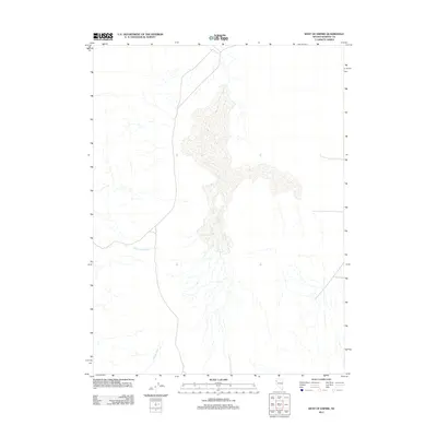
2011 Map of West of Empire
USGS Topo · Published 2011About this map
Willow Creek and Cottonwood Creek define the drainage of this arid Basin and Range landscape within Washoe County. Produced by the U.S. Geological Survey in 2011, this topographical study captures the hydrology and road networks of the high desert just west of the mining and industrial hub of Empire. The terrain is characterized by broad alluvial fans and ephemeral stream channels that flow toward the desert floor. This modern survey serves as a vital record of the natural topography and remote infrastructure in the northwestern Nevada desert, illustrating the sparse but critical water resources that have dictated movement and settlement patterns in the region for generations.
Find a feature on this map
2 named features on this map. Tap any name to fly to it.
Don’t see what you’re looking for? This feature index may not catch every label — zoom into the map to look around manually.
Map Details
Editions of this 2011 West of Empire Map
This is the sole edition of this map. No revisions or reprints were ever made.
Other maps of this area

1886 · Granite Range
USGS Topo · 1:250,000

1894 · Granite Range
USGS Topo · 1:250,000

1955 · Lovelock
USGS Topo · 1:250,000

1959 · Lovelock
USGS Topo · 1:250,000

1964 · Gerlach
USGS Topo · 1:62,500

1964 · Kumiva Peak
USGS Topo · 1:62,500

1965 · Fox Range
USGS Topo · 1:62,500

1980 · Wall Spring
USGS Topo · 1:24,000

1980 · Smith Canyon
USGS Topo · 1:24,000

1981 · Gerlach
USGS Topo · 1:100,000