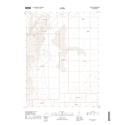
2018 Map of West of Empire
USGS Topo · Published 2018About this map
Fox Range peaks dominate the western portion of this Great Basin landscape, giving way to the expansive flatlands of the Black Rock Desert to the east. This 2018 survey by the U.S. Geological Survey captures a stark geological transition where steep canyons meet prehistoric lakebed sediments. The few drainages present, such as Cottonwood Cr and Willow Cr, flow from the high ridges toward the desert floor, reflecting the traditional hydrology of northern Washoe County. This area is characterized by vast Public Land Survey System divisions, including t31n r22e and t31n r23e, showing the structured grid applied to this arid terrain. For those interested in the natural boundaries of the Nevada desert, this map illustrates the precise meeting point of the range and the playa.
Find a feature on this map
13 named features on this map. Tap any name to fly to it.
Don’t see what you’re looking for? This feature index may not catch every label — zoom into the map to look around manually.
Map Details
Editions of this 2018 West of Empire Map
This is the sole edition of this map. No revisions or reprints were ever made.
Other maps of this area

1886 · Granite Range
USGS Topo · 1:250,000

1894 · Granite Range
USGS Topo · 1:250,000

1955 · Lovelock
USGS Topo · 1:250,000

1959 · Lovelock
USGS Topo · 1:250,000

1964 · Gerlach
USGS Topo · 1:62,500

1964 · Kumiva Peak
USGS Topo · 1:62,500

1965 · Fox Range
USGS Topo · 1:62,500

1980 · Wall Spring
USGS Topo · 1:24,000

1980 · Smith Canyon
USGS Topo · 1:24,000

1981 · Gerlach
USGS Topo · 1:100,000