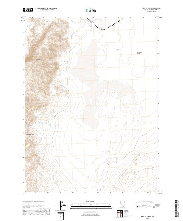
2021 Map of West of Empire
USGS Topo · Published 2021About this map
The Fox Range defines the western landscape of this Nevada survey, its eastern slopes descending toward the iconic expanse of the Black Rock Desert. This transitional zone where mountain meets playa is marked by the deep Cottonwood Basin and the intermittent drainage of Cottonwood Cr and Willow Cr. While the terrain appears largely unsettled, the complex network of Public Land Survey System township and range lines, such as t31n r22.5e, reveals the systematic division of these arid lands for grazing or mineral claims. The map illustrates the stark contrast between the steep elevation changes of the mountains and the flat, silty basin that characterizes this part of Washoe County.
Find a feature on this map
14 named features on this map. Tap any name to fly to it.
Don’t see what you’re looking for? This feature index may not catch every label — zoom into the map to look around manually.
Map Details
Editions of this 2021 West of Empire Map
This is the sole edition of this map. No revisions or reprints were ever made.
Other maps of this area

1886 · Granite Range
USGS Topo · 1:250,000

1894 · Granite Range
USGS Topo · 1:250,000

1955 · Lovelock
USGS Topo · 1:250,000

1959 · Lovelock
USGS Topo · 1:250,000

1964 · Gerlach
USGS Topo · 1:62,500

1964 · Kumiva Peak
USGS Topo · 1:62,500

1965 · Fox Range
USGS Topo · 1:62,500

1980 · Wall Spring
USGS Topo · 1:24,000

1980 · Smith Canyon
USGS Topo · 1:24,000

1981 · Gerlach
USGS Topo · 1:100,000